New 42-day free trial Get it now
US Reverse Geocoding
Use reverse geocoding to easily convert latitude and longitude coordinates to an address and enhance your user experience, optimize logistics, and make data-driven decisions.
Try US Reverse Geocoding API tool live
Input fieldsValues
curl -v "https://us-reverse-geo.api.smarty.com/lookup?key=&latitude=&longitude="
Implement in the language of your dreams with our choice SDKs.

Streamline Operations
Smarty's US Reverse Geocoding simplifies latitude and longitude coordinates, and we'll return human-readable addresses.

Boost Customer Satisfaction
Organizations can ensure consistent and uniform address data by utilizing reverse geocoding to convert coordinates to addresses.

Enhance Business Strategy
US Reverse Geocoding allows you to append longitude and latitude to addresses, create geotargeted campaigns, optimize store location selection, and more.
Our results
Lightning-fast reverse geocoding API
%
Rooftop accurate geocodes
M+
US addresses available
B
Addresses processed all in a day's work
K
Get speeds up to 10,000 times faster
How it works
US Reverse Geocoding converts latitude and longitude coordinates to addresses in 4 steps.
Step 1
Locate
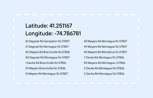
Creates a bounding box of the closest addresses
Step 2
Narrow
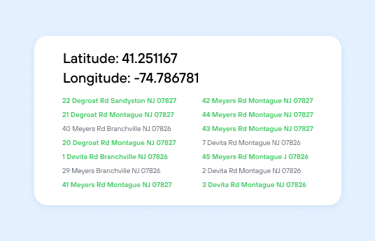
Identifies the 10 addresses with the closest match
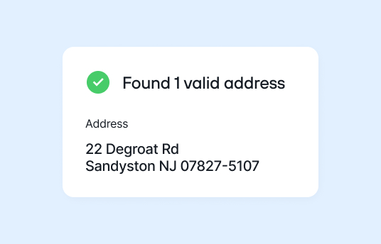
Step 3
Verify
Verifies the geocoded addresses are authentic and accurate
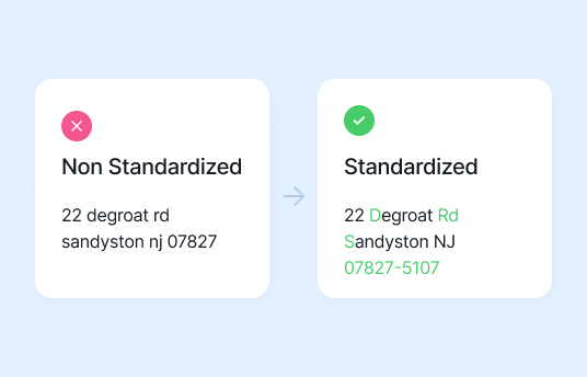
Step 4
Standardize
Formats each result as a human-readable address per USPS standards

Single reverse geocoding
Enter individual reverse geocoding lookups from your dashboard.

Batch reverse geocoder
Upload thousands of coordinates in a CSV or Excel spreadsheet.

Reverse geocoding API
Convert latitude and longitude coordinates to addresses systematically.
How you win with US Reverse Geocoding
Experience an easy-to-use reverse geocoder that makes identifying addresses near coordinates a breeze.
Verified addresses
Access the verified and standardized street address and postal code with every address returned.
Optimize operations
Utilize reverse geocoding to enhance your fleet management, delivery, technician deployment, and more.
Strategic growth
Develop more informed strategic growth plans by leveraging geocodes to enhance location marketing analysis.
Rooftop-accurate geocodes
Get the precise geographic coordinates of each primary structure identified with reverse geocoding.
Enchant customers
Refine checkout flows and forms using reverse geocoding to predict customer addresses quickly and accurately.

Reverse geocoding API
Switch to a cloud-based reverse geocoding API and eliminate the hassle of managing an on-premise system without sacrificing security.
How reverse geocoding helps across industries
Telecom
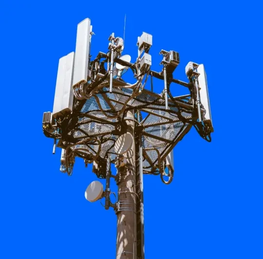
From expanding networks to managing network congestion, reverse geocoding is a valuable tool for telecommunications companies. By connecting quality of service metrics to location data intelligence, telecommunications companies can stay ahead of customer demand and service issues.
P&C Insurance
When natural disasters strike, insurance companies are overwhelmed with claims. However, evaluating damage is tricky when neighborhood signs with street names and home addresses are wiped out. Reverse Geocoding can work with CAT management systems to identify addresses without physical indicators.

Health and Human Services (HHS)
HHS can tailor public health campaigns to specific regions or communities by analyzing demographic data and using reverse geocoding. They can create targeted messaging about vaccination drives, health screenings, or awareness programs based on the specific health concerns prevalent in those areas.

Retail and Ecommerce
Reverse geocoding upgrades retail and eCommerce processes. By converting geographic coordinates into clear addresses, you get precise customer insights. You also empower your businesses with customer behavior insights across different regions. Best of all, each reverse geocode provides clarity by aiding in strategic decision-making, inventory management, and store placements based on real-time customer data.

Crystal clear documentation
HTTP request parameters
Read information on programming language, URL construction, supported methods/verbs, and additional instructions.
Input fields and query string parameters
Learn the additional parameters to configure the required fields, including latitude and longitude coordinate structure requirements.
HTTP response
View possible values for status codes and the importance of using a tried and tested JSON parser for your specific programming language.
HTTP response body
Review the definitions of values that may be returned with each reverse geocoding response, including ZIP Code, street address, and distance.

See how others are using Smarty
FAQ
What is reverse geocoding?
Reverse geocoding converts a location's latitude and longitude into an address. Smarty's reverse geocoder receives the longitude and latitude and deliver the 10 nearest addresses to that location. Businesses empowered with appended address data from reverse geocoding can make more precise data-based decisions, streamline operations, and deliver location-specific customer experiences.
How does reverse geocoding work?
The most efficient way to incorporate reverse geocoding is with a cloud-native system like Smarty's US Reverse Geocoding API. Being cloud-native makes integrating with your existing service providers and applications easy.
What are the benefits of reverse geocoding?
A reverse geocoding response translates each latitude and longitude into a human-readable address. Businesses can leverage accurate geocodes to improve navigation, target new markets, and simplify data interpretation for better decision-making.
What is a reverse geocode lookup?
You use a lookup each time you call the US Reverse Geocoding API and convert a latitude and longitude to an address. Custom US Reverse Geocoding plans range from 25,000 monthly lookups up to unlimited lookups.
How do I purchase reverse geocoding?
There are several ways you can purchase US Reverse Geocoding. You can buy Smarty's monthly and yearly US Reverse Geocoding online. Our online plans come with a set number of lookups you choose at checkout. Additionally, if your business requires more than 25,000 lookups, our address experts can customize a plan to suit your business. Learn more about unlimited lookups.
What is a geocode?
A geocode is a set of geographic coordinates that precisely identifies a location. Address geocoding is used in mapping, navigation systems, and various location-based services to pinpoint and represent locations accurately. They’re a universal way to identify and reference places across different applications and platforms.
More FAQs
Select a category to see more information about a certain topic.
US Reverse Geocoding pricing
We meticulously craft personalized solutions tailored to every facet of our customers' business needs. Choose the perfect plan that promises growth and prosperity.Free trial
$0
42 days
 1,000 lookups
Professional
$54
per monthTerm
Address Lookups per month
Custom
Custom plan for your company's needs
Choose your features Custom lookups / year
 Custom lookups / second
 Custom legal terms
 Enhanced data privacy
 Custom lookups / year
 Custom lookups / second
 Custom legal terms
 Enhanced data privacy

